When we had finished our rafting trip & on the way back into town, Ross proclaimed he wanted to go bungi jump. Of course my response was, sure. Ross replied that he was about 75% sure he wanted to take the jump. Our plan the next day was to head straight out for Milford Sound. I told him I would jump as well, but he had to be 100% sure before our plans got changed. Somewhere back in town, Ross said he was like 90% sure he wanted to jump. I of course replied, that ain't 100% yet. After dinner, Ross said he was 100% sure. I told him I would ask again in the morning & if he was still 100%, we'd drive back up to the Kawarau River bridge before taking off to fiordland.
The next morning, I asked & Ross said he was still 100%. We drove the 12 miles back east to the river, got out & walked into the facility. Diantha asked if we were going to walk over to the edge and watch before we signed up. No way! And take the chance of a mind change!!! So Ross & I stepped up, paid the fee & were told to return in 20 minutes to weigh in. THEN, we went & watched some jumping. We returned, weighed in & walked up to the bridge where we were handed a harness as we waited in line. Diantha had gone below to take pictures & watch us sweat!
Ross went ahead of me, not once did he outwardly whimper or suggest he was going to change his mind. He was called into the staging area, harnessed in & hopped over to the edge. I watched him wave to the camera, thumbs up, then he jumped, a very proud moment!!!! I was very impressed. Those of you who know him, know this was a monster demonstration of bravery. My hats off to you Ross! First in the family!
So, I was called into the staging area right after Ross jumped. I was harnessed in and hopped over to the edge. Now, I became even more impressed with the fact Ross had jumped when I made the mistake of looking down. 43 meters to the river. The water was beautiful blue, calm & a long,long way down. The guy who had harnessed me in had me hop alittle closer to the edge. I grabbed the hand grip to hold onto for balance. The guy said I was ready, but I would need to let go of the grip. I really didn't want to & wondered why I had agreed to do this. I was petrified on the inside, but be damned if I showed it, particularly since I could see Ross at the bottom looking up & watching me, Daintha waiting with the camera & about 20-30 people waiting to see me take the step off the ledge. So, I cleared my mind, & did a swan dive. I don't really remember the trip down, but do recall slowing as the bungi rope started to pull at my legs. I was supposed to hit the water, but missed by a yard. As I hung there waiting for the rubber raft to come out & get me, I did check to see if I had wet myself & was glad to learn I hadn't. I got lowered into the boat, unloaded at the ramp & walked up the path with Ross to meet Diantha, higher than a kite.
Needless to say, this was quite a rush, 6-8 seconds worth. Did it & doubt I ever will again, particularly if it is not over water. The irony, Ross was ready to go back & do it again. I was ready to settle into a nice stress-free drive south and west to fiordland!
Thursday, April 29, 2010
Wednesday, April 21, 2010
Say what?
So before we risked our lives down That Road (I dare anyone to Google Earth it and check out the photos) to splash down the river, we pulled over at the famous New Zealand bridge where folks can bungy jump. We watched in amazement and oohed and ahhed. As we left, Ross said to me in the car, "I'm want to bungy jump." I kept my eyes straight ahead. I raised one eye brow - the one he couldn't see. I said, "Oh. Maybe there's time tomorrow." Whatever!, I foolishly thought . . .
Sunday, April 18, 2010
NZ - Queenstown, Day ???, who's counting!!
Queenstown is an adrenelin junky's dream come true! Beautifully situated on a huge glacier carved lake in the middle of the southern Alps.
We decided to get in some whitewater rafting on the Shotover River & booked for the afternoon half day trip. We were bused from downtown Queenstown out to Arthur Point where the company has their water based activities facilities on the river. We were suited up in wetsuits, booties, splash jacket, helmet & life jacket. Then back on the bus for the ride of our lives!! It has been a long time since I have been on a road that has scared me like this one. In fact, our boat guide said this road was ranked as the 15th worst road to drive in the world. At the time, I thought it was #1. The bus is also hauling a trailer with 4 rafts. The rock ledge road is barely 8 feet wide along the CANYON, sheer drop straight down & as I looked out & down, many times I could not see any road, I mean nothing!!!!!
So we got down to the put in beach, put boats in the water, grabbed oars, safety demo & then assigned to boats, 6 per + our boat guide, Kyle, who is from the US. We spent about 3 hours (about 17 kilometers) running the Shotover, going thru some 3-4 rated rapids. There are a few 5's , but this is the end of their summer, early fall so the river was down. We also went thru a lengthy tunnel carved out of the cliff for diverting water during the area gold rush. The trip was a blast! Lots of fun. Ross & I were at the front of the boat & got pretty wet & Diantha was at the left rear staying dry. Would I do it again? Yes, but I would have to be knocked out to take that bus trip again!
The next day.... to be continued
Wednesday, April 14, 2010
Day 4: New Zealand
You know how we felt trying to walk today! But it was so worth it - bridges and all! Ross wanted to walk up to the "face" of the second glacier nearby, Fox. So we at least hobbled up to it! Again, amazing and beautiful. The sun was shining and the sky was brilliant blue. We were still in sweatshirts, jackets, and gloves! The glaciers here are particularly interesting because they come down from the Alps into the rain forests of the west coast here. How unusual! So the views are of dramatic snowy peaks on the mountains and lush rainforest all around.
We spent the day driving south along the west coast. This is very rugged terrain, and the cliffs and rocks below remind us of the most dramatic sections in Oregon. At one point the road went along the ocean, so we stopped to get out and touch the Tasman Sea. The water was cold, the sand was rocky, and sparkling white rocks, perfectly rounded and smooth dot the shoreline. I collected one the exact shape of an egg. I said to Ross, "Where is everyone? Why aren't people down here swimming or at least playing at the beach? It's beautiful here!" Then the sandflys hit. Within moments we were eaten alive! So we jumped into the car squealing and drove with the windows blowing the air through! The bites are still painful three days later!
Our drive took us away from the Alps and rainforest, away from the ocean to the farmlands as we headed south east towards Wanaka. The countryside here reminds us of Oregon, but there is something more enchanting about it. Is it that it's New Zealand?? Could be. The farmhouses and out-buildings are rustic and quaint. Sheep dot all the fields, as do cattle and elk. Yes elk! Farms of elk. Pat salivates as we drive past.
It is fall, and the trees are turning color. It's our first real visual that it is fall, since New South Wales doesn't really experience a change in the season as we know it. So the farmland and countryside are gorgeous with the different trees.
Wanaka is a town situated on a beautiful lake, very much like Wallowa Lake in north eastern Oregon. We pulled into the Youth Hostel there and set up camp in our bunk room! The hostel was cozy and comfortable, very much like a ski lodge with spectacular views out over the lake. Not bad for $50 US for all three of us! We perused the brochures looking for tomorrow's adventures in the Queenstown area, known for thrills and adrenaline activities . . . I left the guys to this, since the suspension bridges were enough adrenaline for me for awhile, and made a cup of tea. By dinner we were booked on a white water rafting trip for 1 p.m. tomorrow. I was assured nothing was high up . . .
New Zealand or Bust!
We have two weeks of school holidays (school begins for the school year Jan. 28 and goes for 10 weeks, then 2 weeks off, then 10 weeks on, etc. until Dec. 18), so we have taken off for New Zealand. Now we are on the last night of our trip, and I, for one, am melancholy! It has been an amazing time, so I'll begin to describe each of the days.
We left Easter Sunday for Brisbane where our NZ flight would leave from. We visited the Australian Museum, home of Steve Irwin's family, to see the crocodiles and feed the elephants. They put on quite a show, ending with the trainer jumping into the croc's water and swimming away so he'll chase him through the exit, which he does. Show or no show, in the end, no one is really kidding!
Tuesday we landed in Christchurch and stayed the night at a small backpacker's hostel that Ross coined as "definitely hippie." Okay, it was. But very cozy, too, and had a marvelous, enormous cat that we loved all evening. It had a "car-be-que" in the back yard, as well as a converted 1950's bus where the caretakers reside. We put on our sweatshirts and jeans for the first time since being in Tasmania in January. No dogs on the "car-bie" for us - it was cold out there!
Wednesday morning, Day 2, we drove in our slightly okay very used rental car up over Arthur Pass through the Southern Alps from the east coast of New Zealand to the west coast. The pass is where the Aussie-favorite ski resorts are (think Hoo Doo in 1969), and it's also where many scenes from Lord of the Rings were filmed. Pat loved it! Aaron, you would have been going crazy - we'll show you pictures! It reminded me of Sonora Pass with the steep grades and beautiful meadows.
We passed through Ross, New Zealand, which was not much, no offence, and stopped only long enough to take a picture of Ross next to the town sign. I would have bought a tee shirt if they'd had a store . . .
By evening we were at our Youth Hostel in Franz Josef just a stone's throw from the glacier. The air was cold, the beer was colder, and our own pasta and sauce tasted great! The most fun about cooking in the big group kitchens is watching all people making their dinners. Since there are probably 7-8 nationalities represented on any given night, the foods, languages, and customs happening all around us are entertaining and educational! We've watched some very interesting breakfasts, particularly, unfold. Rice with canned smoked fish (very sardine-y looking to me!), avocado on toast, oatmeal that looked anything but oatmeal, and many assorted mysterious packages printed in Asian languages being consumed all around us!
Day 3 we spent on an AMAZING hike up to look out over the glacier. It was 12.3 km, 5 and 1/2 hours, and arguably the most interesting hike we've ever taken. We passed over many creeks, including one that we had to bridge ourselves (read Pat and Ross mostly collecting very large rocks and splashing around to set them right for moi).
The hike had three, count them, 3, suspended foot bridges over very very very deep canyons. Anyone who has climbed trees and held harnesses for and with me knows that I am not a fan of things high up. The first went over the actual river from the glacier and was two planks wide and very long. I sang my way across (who doesn't love James Taylor at a time like that?) which does not mean I was dancing and singing. That means I had to SERIOUSLY calm and distract myself to get the heck across. When the second one came up I thought, okay, here we go again, and this one looks nice and small - I can handle this one. That was until Ross looked over half way across and yelled, "Hey Pat, this one goes down really far!!" Oh. And they actually stop and take pictures of the beautiful canyons/waterfalls below halfway across! I'm too afraid I'll run out of verses of Shower the People for that.
We also climbed a contraption that was wooden planks lodged around a rounded rock face with sort-of steps bolted in so that you didn't shimmy right off into the Abyss Below. Good thing I know a lot of James Taylor songs. It ended at the itty bitty picnic table on the perch looking over the glacier. Yea! No it didn't end. It half-wayed at that point, cuz we got to turn around and come back down the same way! Over the same lovely bridges with the same songs! The view from the top was fantastic. It was the guys' first glacier and my second one since 35 years ago in Alaska with my mom and two sisters.
The beer tasted even better that night, and since we could barely walk, laying low playing cards was just what the doctor ordered!
Monday, March 29, 2010
Mt. Warning: We Should Have Known
You don't take a hike like that and also walk the next day.
We joined the Teacher Exchange League for their weekend trip to Murwillumbah - don't try to pronounce these names! The locals don't, either; it's called Murbah. Brisbane is "Brizzie," and Woolgoolga is "Whoopi." Anyway, Pat and I drove north 4 hours (Ross was at his basketball tournament nearby with his team) and stayed the night with a teacher who offered us her guest room. Her home was a villa, practically, up on the top of a small mountain looking out to Mt. Warning. Her wrap-around veranda (very Australian) was magnificent with views in all directions.
Saturday we met for the hike, 2 hours up through the rain forest with the last 100 meters involving a chain to grasp and footholds straight up. The top is a cone with views literally in all directions. It was a fairly clear day, and we could see out to the ocean of Byron Bay (see Pat's story below!!). There were probably 15 of us, Americans (Colorado), Brits, and Canadians, as well as local Australians who have exchanged in the past. Such a great group of people from all over New South Wales.
On the way down someone reported seeing two Brown Snakes (yup, the really really poisonous ones . . .), so I came down that trail very very fast. Every stinkin' root and vine on the ground was a potential Bad Boy, so I watched them all as I careened down the slippery rocks! I have the bruises to show for my fall/tumble at a not-so-graceful moment, but it was all worth it! Do you think that beer tasted good at the pub?!
We ended with dinner at the Pizza and Thai Food (!) restaurant, sitting outside in the balmy evening until late sharing stories, laughing, and making even more friends.
Sunday we were able to make it down to Ross' tournament and catch up on the drive home.
Sunday, March 21, 2010
Except for a couple rest days & doing laundry, Tim & I stayed busy during his 3 week vacation to Australia.
After picking Tim up at the Sydney Airport, we spent a couple days touring Sydney. The trip from Sydney to Urunga is a little over 500k & about a 6 hour drive.
We went to a rugby game between the Australian Army & the town of Bellingen, about 5 miles west of Urunga. The following day, Tim, Diantha & I caught a bus with other Aussie friends down to Port MacQuarrie for a concert at a vineyard featuring Micheal McDonald (formerly with the Doobie Brothers) & Boz Skaggs. We actually missed Mic Fleetwood who had played earlier.
We tried surfing one day.
Then we took off to head north to the Great Barrier Reef. We decided to head inland first so that we did not have to drive the same stretch of highway twice coming home. So we took of west bound, without paying one ounce of notice to weather conditions. We traveled thruough Dorrigo, Guyra, Inverell, Warialda and North Star. Just outside of North Star, a turtle is crossing the road. Tim, being the good samaritan he is, moved the turtle to safety. The weather was looking bleak.
We continued on through Boggavilla and Goodiwindi. We are now on Hwy 39 or A5. On the map, this looks like a good road, major thoroughfare. Everything is pretty wet. Even the floodways! A floodway, by the way, is nothing more than a dip in the road where a bridge should be, with a meter stick, most of the time, to indicate the depth of the water on the road you shouldn't be crossing!
So, we drove through a number of these until we came to one that showed the water depth at about 0.4 meters. As we sat contemplating what to do, a small compact appeared on the opposite side. The drive got out, walked into the water then back to his car & sat. Another car came up behind us,stopped & asked if we were okay. He then said he was going through & did. The compact on the other side came through next so we went ahead through. We passed through at least a dozen more floodways with water, none higher than 0.4ish. We passed throught the community of Moonie, our ultimate destination was Miles. We crossed the Moonie River, swollen to about 6-8" below the bridge. We passed the through several more floodways, a couple of which had some pretty fast moving water. We passed by the community of The Gums, driving about 3-4 miles north when we came to a rather large flooded section of the low(not hi)way, Cattle Creek. Looked okay when we started, but as we got into it, we began pushing water up over the front of the car & decided rather quickly to back out. And as we were, the fan belt began singing. We made it out!!!!!
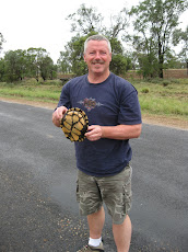
We turned around and headed back to The Gums, then east, hoping to get to Tara. Well, we got to the same creek, up stream though. The photo is of Tim checking the depth of the floodway. A farmer came through and said we may get through here, but the next one we would not. He took us to another place he thought we might get through. Not likely as we watched the front end of his 4x4 drop into large holes of water.
Back to The Gums and south bound, hoping to get somewhere, anywhere dry. We passed back through floodways that had stronger currents & after getting through, promises of not doing that again. Unfortunately, we returned to the Moonie River, which now had a meter of water running over the top of the bridge.
Tim & I decided to go back to a small section of high ground, perhaps an elevation of 15 feet! This country is flat, flat, flat! We had packed pillows & sheets, bread, peanut butter, jam & plenty to drink. So we settled in to sleep & wait out the flooding.
A car came out of a driveway, stopped & the couple asked if we were okay. They told us the rancher from where they'd come said to come down to his place for the night. They were very kind, but we didn't take the offer seriously. A half hour later, another vehicle came out & pulled up behind us. The driver, Andrew, invited us to his farm/ranch bunkhouse for the night. We followed him in. After meeting Cameron, his ranch hand and visiting a while, he graciously provided Tim & I with 'chops', eggs, coffee & milk for our breakfast, then showed us to the bunk house.
Andrew Hirst, Owner/Manager, 'Twyford Pastoral Company', Kilawarra, Tara, Queensland met us the next morning after Tim cooked breakfast. He showed us aroung his 10,000 acre farm/ranch, named Killawarra. Andrew had mentioned goats having appeared on the property, and we spotted them in 2 groups, billys & nannys. Andrew had aready been checking with local ranchers about road conditions and a safe way out for us. He wisely suggested we hold tight for a while. But in the mean time, would we like to herd the goats for him. Sure!!!! So, Cameron, Tim & I jumped on 3- 250cc dirt bikes. Now if you check out the picture of Tim, notice, he also has 2 additional passengers, the 2 ranch dogs!!! They ended up actually riding with Andrew in the Ute. Off we went on motorcycles to herd goats. Who really didn't want to be herded, rather, ran back into the woods. We chased the goats around for awhile but were not successful in getting them herded up. If there was a benefit to Andrew, he learned they were feral. (They have since vanished from the property according to a recent email from Andrew).
Riding the motorbikes back, we had the pleasure of company. About 50 yards to our left, we had kangaroos bouncing along with us.
We met Jaime & 15 month old Phoebe Hirst. Jaime & Andrew invited us to their home for lunch after cleaning up the bikes. Great meal, great company, great hospitality! And thanks for showing us the back roads out to Tara. You guys are always welcome at our home, anytime!
So, Tim & I continued on through Tara, Dalby, Bell, Kumbia (Tim started singing, Kingaroy & we stayed in Wondai.
The next day, we traveled through Murgon, Gayndah, Mundubbera,Monto, Biloela & on into Rockhampton. All the rivers & streams we passed were flooding or close to flood stage. We were lucky!!! We stayed in Emu Park on the coast. The ocean was mocca colored. We elected to continue north up the coast in hopes of finding clear water & nicer access to the GBR.
WE drove through Yeppon, north on the A1 to Marlborough, Sarina, Mackay (pronounced muci), Proserpine & to Airlie Beach. We took a day trip out to the Whitsunday Islands group, snorkeling in the reef of Border Island, then to Whitsunday Island & Whitehaven beach for swimming & lunch. Water was pretty clear, sunny finally. Beautiful place and according to our boat driver, the fourth most photographed place in Australia, behind, Sydney bridge, opera house & Ayers Rock. Airlie Beach also has a fantastic public pool called the lagoon, which is next to the ocean, & 100 yards long by 30 yards wide or so.
Leaving Airlie, we headed south, through Gin Gin, staying in Maryborough. The freeway from Childers to Gympie was covered in potholes & in serious need of repair.
We drove down the Sunshine Coast (water still mocha colored) & on to the Australian Zoo outside of Beerwah, north of Brisbane. Highway 6 off the A1 Pacific Coast highway has been renamed Steve Irwin Way. Very nice, well kept facility. Animals all looked healthy. We traveled down to the Gold Coast, staying in Surfers Paradise.
We drove to Byron Bay, spent the day swimming & body surfing, another rare sunny day! We drove back to Urunga that night.
We drove to a small community called Nymboida, about 70-80 miles away. The museum, tavern, motel & restaurant are owned by Russell Crowe. He has contributed several of his movie momentos to the museum & photos are in the restaurant. The museum is small, but fun. Thank you Mr. Crowe.
Graeme & Blue took us up to Ebor, the fish hatchery & a little fly fishing.
Thanks for coming over Tim, it was a great adventure, one I'm sure could never be duplicated!
After picking Tim up at the Sydney Airport, we spent a couple days touring Sydney. The trip from Sydney to Urunga is a little over 500k & about a 6 hour drive.
We went to a rugby game between the Australian Army & the town of Bellingen, about 5 miles west of Urunga. The following day, Tim, Diantha & I caught a bus with other Aussie friends down to Port MacQuarrie for a concert at a vineyard featuring Micheal McDonald (formerly with the Doobie Brothers) & Boz Skaggs. We actually missed Mic Fleetwood who had played earlier.
We tried surfing one day.
Then we took off to head north to the Great Barrier Reef. We decided to head inland first so that we did not have to drive the same stretch of highway twice coming home. So we took of west bound, without paying one ounce of notice to weather conditions. We traveled thruough Dorrigo, Guyra, Inverell, Warialda and North Star. Just outside of North Star, a turtle is crossing the road. Tim, being the good samaritan he is, moved the turtle to safety. The weather was looking bleak.
We continued on through Boggavilla and Goodiwindi. We are now on Hwy 39 or A5. On the map, this looks like a good road, major thoroughfare. Everything is pretty wet. Even the floodways! A floodway, by the way, is nothing more than a dip in the road where a bridge should be, with a meter stick, most of the time, to indicate the depth of the water on the road you shouldn't be crossing!
So, we drove through a number of these until we came to one that showed the water depth at about 0.4 meters. As we sat contemplating what to do, a small compact appeared on the opposite side. The drive got out, walked into the water then back to his car & sat. Another car came up behind us,stopped & asked if we were okay. He then said he was going through & did. The compact on the other side came through next so we went ahead through. We passed through at least a dozen more floodways with water, none higher than 0.4ish. We passed throught the community of Moonie, our ultimate destination was Miles. We crossed the Moonie River, swollen to about 6-8" below the bridge. We passed the through several more floodways, a couple of which had some pretty fast moving water. We passed by the community of The Gums, driving about 3-4 miles north when we came to a rather large flooded section of the low(not hi)way, Cattle Creek. Looked okay when we started, but as we got into it, we began pushing water up over the front of the car & decided rather quickly to back out. And as we were, the fan belt began singing. We made it out!!!!!
We turned around and headed back to The Gums, then east, hoping to get to Tara. Well, we got to the same creek, up stream though. The photo is of Tim checking the depth of the floodway. A farmer came through and said we may get through here, but the next one we would not. He took us to another place he thought we might get through. Not likely as we watched the front end of his 4x4 drop into large holes of water.
Back to The Gums and south bound, hoping to get somewhere, anywhere dry. We passed back through floodways that had stronger currents & after getting through, promises of not doing that again. Unfortunately, we returned to the Moonie River, which now had a meter of water running over the top of the bridge.
Tim & I decided to go back to a small section of high ground, perhaps an elevation of 15 feet! This country is flat, flat, flat! We had packed pillows & sheets, bread, peanut butter, jam & plenty to drink. So we settled in to sleep & wait out the flooding.
A car came out of a driveway, stopped & the couple asked if we were okay. They told us the rancher from where they'd come said to come down to his place for the night. They were very kind, but we didn't take the offer seriously. A half hour later, another vehicle came out & pulled up behind us. The driver, Andrew, invited us to his farm/ranch bunkhouse for the night. We followed him in. After meeting Cameron, his ranch hand and visiting a while, he graciously provided Tim & I with 'chops', eggs, coffee & milk for our breakfast, then showed us to the bunk house.
Andrew Hirst, Owner/Manager, 'Twyford Pastoral Company', Kilawarra, Tara, Queensland met us the next morning after Tim cooked breakfast. He showed us aroung his 10,000 acre farm/ranch, named Killawarra. Andrew had mentioned goats having appeared on the property, and we spotted them in 2 groups, billys & nannys. Andrew had aready been checking with local ranchers about road conditions and a safe way out for us. He wisely suggested we hold tight for a while. But in the mean time, would we like to herd the goats for him. Sure!!!! So, Cameron, Tim & I jumped on 3- 250cc dirt bikes. Now if you check out the picture of Tim, notice, he also has 2 additional passengers, the 2 ranch dogs!!! They ended up actually riding with Andrew in the Ute. Off we went on motorcycles to herd goats. Who really didn't want to be herded, rather, ran back into the woods. We chased the goats around for awhile but were not successful in getting them herded up. If there was a benefit to Andrew, he learned they were feral. (They have since vanished from the property according to a recent email from Andrew).
Riding the motorbikes back, we had the pleasure of company. About 50 yards to our left, we had kangaroos bouncing along with us.
We met Jaime & 15 month old Phoebe Hirst. Jaime & Andrew invited us to their home for lunch after cleaning up the bikes. Great meal, great company, great hospitality! And thanks for showing us the back roads out to Tara. You guys are always welcome at our home, anytime!
So, Tim & I continued on through Tara, Dalby, Bell, Kumbia (Tim started singing, Kingaroy & we stayed in Wondai.
The next day, we traveled through Murgon, Gayndah, Mundubbera,Monto, Biloela & on into Rockhampton. All the rivers & streams we passed were flooding or close to flood stage. We were lucky!!! We stayed in Emu Park on the coast. The ocean was mocca colored. We elected to continue north up the coast in hopes of finding clear water & nicer access to the GBR.
WE drove through Yeppon, north on the A1 to Marlborough, Sarina, Mackay (pronounced muci), Proserpine & to Airlie Beach. We took a day trip out to the Whitsunday Islands group, snorkeling in the reef of Border Island, then to Whitsunday Island & Whitehaven beach for swimming & lunch. Water was pretty clear, sunny finally. Beautiful place and according to our boat driver, the fourth most photographed place in Australia, behind, Sydney bridge, opera house & Ayers Rock. Airlie Beach also has a fantastic public pool called the lagoon, which is next to the ocean, & 100 yards long by 30 yards wide or so.
Leaving Airlie, we headed south, through Gin Gin, staying in Maryborough. The freeway from Childers to Gympie was covered in potholes & in serious need of repair.
We drove down the Sunshine Coast (water still mocha colored) & on to the Australian Zoo outside of Beerwah, north of Brisbane. Highway 6 off the A1 Pacific Coast highway has been renamed Steve Irwin Way. Very nice, well kept facility. Animals all looked healthy. We traveled down to the Gold Coast, staying in Surfers Paradise.
We drove to Byron Bay, spent the day swimming & body surfing, another rare sunny day! We drove back to Urunga that night.
We drove to a small community called Nymboida, about 70-80 miles away. The museum, tavern, motel & restaurant are owned by Russell Crowe. He has contributed several of his movie momentos to the museum & photos are in the restaurant. The museum is small, but fun. Thank you Mr. Crowe.
Graeme & Blue took us up to Ebor, the fish hatchery & a little fly fishing.
Thanks for coming over Tim, it was a great adventure, one I'm sure could never be duplicated!
Subscribe to:
Posts (Atom)